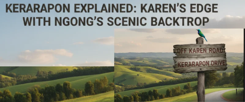
Kerarapon sits at an interface: physically near Ngong and the Ngong Hills, yet residentially, commercially, and socially oriented toward Karen.
In a way, we can best describe that mix as Kerarapon Drive being on the edge of Karen — a Karen fringe that faces Ngong, rather than as part of Ngong itself. In local street talk, we can refer to it as Karen Ndogo – a small Karen.
To further understand this, let us delve deeper into the formalities of the location, as well as the informalities of residential living.
That way, we will understand the differences between Ngong, Karen, and Kerarapon Drive from different angles. The distinction matters for governance, property markets, and how residents live their daily lives.
In this article, you will discover why Kerarapon is better seen as Karen’s fringe, not Ngong, covering location, lifestyle, zoning, and its strong connection to Karen’s amenities.
Kerarapon Drive’s Proximity to Karen
Kerarapon’s proximity to Karen is one of its biggest advantages, both for convenience and lifestyle.
From a realtor’s point of view, I consider Kerarapon as the perfect fallback for anyone who wants to live in Karen but cannot reach the budget ceilings of the properties there.
Below is a quick summary of why Kerarapon is unique to Karen despite being in Kajiado County, and why the tag of Karen Ndogo fully fits it.
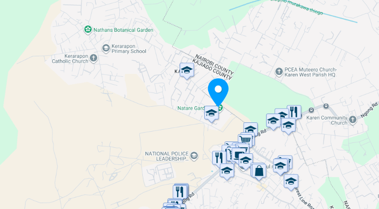
- Short driving distance — Kerarapon Drive connects directly to Karen Road and Ngong Road, putting key Karen destinations just a few minutes away. For example, The Hub Karen, Karen Country Club, and Galleria Mall are typically a 10-minute drive.
- Easy access to daily essentials — Residents can quickly reach Karen’s supermarkets, banks, healthcare facilities, and specialty shops without needing to commute into Nairobi CBD.
- Close to top-tier schools — International institutions like Brookhouse, Hillcrest, and The Banda are within quick reach, making it ideal for families who value premium education.
- Part of the same social and leisure network — Kerarapon residents naturally enjoy the same restaurants, golf courses, equestrian centres, and green spaces that Karen is famous for.
- Well-connected yet private — The closeness to Karen means residents enjoy urban conveniences, while Kerarapon’s location keeps them tucked away from Karen’s busier roads and commercial clusters.
In effect, Kerarapon offers the benefits of a Karen lifestyle—shopping, dining, recreation, and prestige—without being in the middle of its commercial bustle, making it an attractive choice for those seeking peace without isolation.
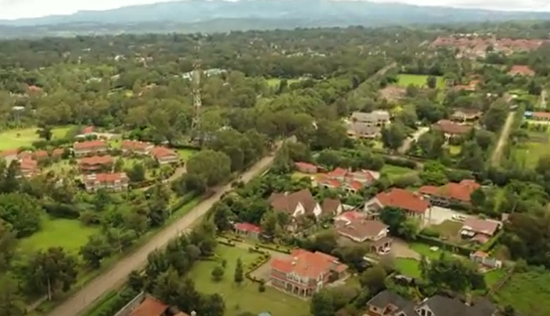
How Kerarapon Drive Mirrors Karen’s Residential Living
Kerarapon offers the space, tranquillity, and exclusivity that define Karen, while its location ensures residents can plug into Karen’s vibrant, high-end lifestyle with ease.
It’s Karen living — just on the edge, with Ngong’s scenic hills in the background.
Kerarapon blends seamlessly into the Karen lifestyle because its residential profile mirrors the Karen’s:
- Low-density housing — Large plots, often quarter-acre or bigger, with maisonettes, bungalows, and gated compounds rather than high-rise apartments.
- Green, quiet environment — Like Karen, Kerarapon is lush and tree-lined, with gardens, hedges, and minimal commercial congestion.
- Security and exclusivity — Many gated communities and private driveways, reflecting the same privacy-oriented culture as Karen.
Its proximity to Karen’s amenities makes it even more ideal for Karen-style living:
- Minutes to Karen’s social and shopping hubs — The Hub, Karen, Galleria, and Karen Crossroads are all a short drive away, meaning residents enjoy world-class retail, restaurants, and leisure without long commutes.
- Access to top schools and healthcare — International schools, private academies, and reputable hospitals in Karen are within easy reach.
- Smooth connection to Nairobi’s upscale networks — Social clubs, golf courses, and equestrian centres in Karen remain part of daily life for Kerarapon residents.
Controlled Development of Kerarapon Drive
Kerarapon maintains a strongly residential character through deliberate land-use restrictions and community planning norms that discourage commercial development.
- Zoning and planning guidelines — Much of Kerarapon’s land is earmarked for residential use, with local authorities and resident associations resisting high-traffic commercial projects.
- Resident-driven controls — Homeowners’ associations often set covenants that limit business premises, noisy activities, or high-density construction, preserving the area’s quiet and exclusive feel.
- No major shopping strips within the neighbourhood — Unlike mixed-use urban centres, Kerarapon has no sprawling malls or high-traffic retail streets inside its core. Residents instead rely on nearby Karen shopping hubs, ensuring local roads remain peaceful.
- Preference for low-impact amenities — When community facilities are allowed (e.g., small schools, churches, or clubs), they are designed to blend with the residential environment, avoiding disruptive traffic or noise.
This intentional discouragement of commercial sprawl ensures Kerarapon remains a leafy, serene enclave.
The absence of large retail complexes, noisy nightlife, or industrial activity allows the neighbourhood to retain the calm, low-density suburban atmosphere that is synonymous with Karen living.
Why Kerarapon feels like an Edge of Karen
Below, I walk through the evidence and the reasons why Kerarapon is better understood as Karen’s fringe rather than Ngong’s neighborhood.

1. Administrative & County Boundaries Matter
Ngong (the town and municipal area) is formally in Kajiado County, while Karen is a suburb inside Nairobi City County.
County and municipal boundaries are the decisive legal/administrative lines that determine services, taxes, governance, and many official addresses.
Ngong’s municipal boundaries and Kajiado County maps place Ngong outside Nairobi County. This makes it unlikely for a place inside Nairobi’s Karen administrative area to be officially part of Ngong town.
2. Postal Addresses, Maps, and Directory Listings: Place Kerarapon with Karen
Public map entries, booking and accommodation listings, and property adverts commonly give Kerarapon addresses as “Karen” (for example, many Kerarapon Drive listings use Karen Rd / Karen as the area).
Commercial directories and real-estate portals treat Kerarapon as an area within the Karen catchment. That consistent addressing practice anchors Kerarapon administratively and commercially to Karen.
3. Real Estate & Market Identity: Kerarapon Markets like Karen
Real-estate agents and property platforms advertise Kerarapon houses and plots as “Karen — Kerarapon Drive” and price them according to Karen’s market position (spacious plots, upmarket finishes, gated compounds).
That matters: markets and buyers treat Kerarapon as part of the Karen market, not Ngong’s market. On the ground, this shapes land use, security expectations, infrastructure investment, and local services.
4. Geography: Physically on the Boundary, but Leaning into Karen
Geographically, Kerarapon sits between Karen proper and the Ngong corridor. It’s physically closer to Karen shopping points and trails into Karen-style residential neighborhoods than to the core of Ngong town.
In practice, that means everyday trips (shopping, schools, clubs) tend to connect Kerarapon residents with Karen’s social and commercial nodes.
Map summaries and local area descriptions regularly describe Kerarapon as a “hidden gem located between Karen and Ngong” or refer to it in the Karen context.
5. Transport & Infrastructure Links Pull Kerarapon toward Karen
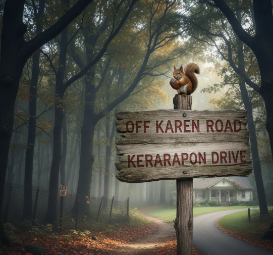
Road naming and addresses (e.g., Kerarapon Drive, often shown off Karen Road) and the flow of local transport routes tend to link Kerarapon with Karen more than with central Ngong.
Where people send mail, which bus routes residents use, and which shopping centres they visit all influence how an area is perceived — and those patterns favour Karen for Kerarapon.
6. Social & Socioeconomic Character Aligns with Karen
Karen is an affluent, low-density, largely residential suburb with large plots and gated properties. Kerarapon’s housing stock, plot sizes, and real-estate presentations reflect that same profile (maisonettes, quarter-acre plots, gated developments).
Ngong town, by contrast, is an urbanizing municipality with a different land-use mix and demographic profile. Those on-the-ground differences reinforce Kerarapon’s identity as Karen’s edge.
7. Local Usage & Perception are Decisive
Place identity isn’t only legal: what residents, businesses, and services call a place matters. Local adverts, property descriptions, accommodation listings, and community posts consistently use “Karen” when referring to Kerarapon Drive.
Over time, that practice shapes both perception and practical outcomes (e.g., where people search for houses, which schools are considered local).
So what about Ngong? Why the confusion?
Ngong’s name applies to the town and to the broader Ngong Hills area. Many people colloquially refer to anything near the Ngong Hills as “Ngong,” which creates overlap in everyday speech.
Geographically, this causes understandable blur: Kerarapon is near the Ngong corridor, so casual descriptions sometimes link it to Ngong.
And administratively, it is in Ngong. However, in terms of residential living, Kerarapon aligns with Karen — hence the better label is “edge of Karen.”
Conclusion
Kerarapon Drive is one of those Nairobi localities that sit on a geographic and social seam: close to Ngong and the Ngong Hills, but consistently referred to, addressed and marketed as part of Karen.
Saying Kerarapon is an “edge of Karen” rather than “part of Ngong” isn’t just hair-splitting — it reflects administrative boundaries, postal and mapping practice, real-estate identity, transport links, and local perception.